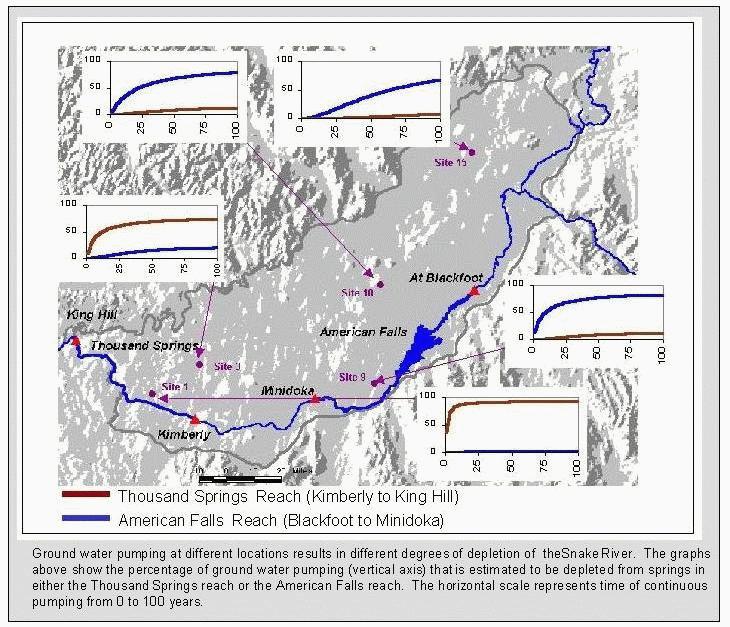
Labels:text | map | diagram | screenshot | atlas OCR: 100 100 50 0 0 8 8 8 ₽ 8 25 75 25 75. Site 15 100 0 0 8 At Blackfoot 25 75. 50 100 Site 10 King Hill 50 Thousand Springs American Falls 0 8 25 75. Site J 50 Site 1 Sito g Minidoka Kimberly 8 8 75 25 Thousand Springs Reach (Kimberly to King Hill) American Falls Reach (Blackfoot to Minidoka) Ground water pumping at different locations results in different degrees of depletion of theSnake River. The graphs above show the percentage of ground water pumping (vertical axis) that is estimated to be depleted from springs in either the Thousand Springs reach or the American Falls reach. The horizontal scale represents time of continuous pumping from 0 to 100 years.